Smart Farms Managing Wild Herds Project
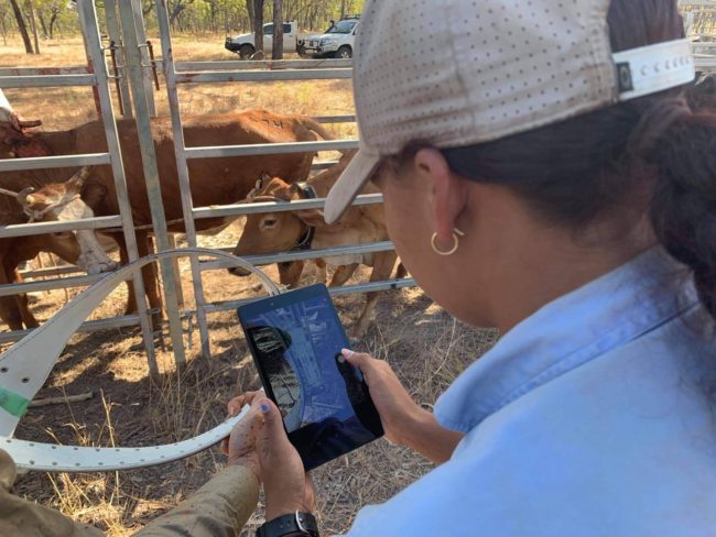
Kelsey Harrigan, Normanby Land Management, uses I-Tracker to collect data on herd tracking collars.
‘Landscape scale herd management of unmanaged cattle and buffalo in northern Australian Indigenous estate to support economic development, landscape restoration and protection of cultural and environmental assets’.
The Smart Farms Project is about landscape scale (Northern Territory and Queensland) herd management of unmanaged cattle and buffalo on the northern Australian Indigenous estate. This project seeks to support economic development, landscape restoration and protection of cultural and environmental assets.
This project will address the significant challenge of creating enterprise from largely unmanaged stock in vast northern Indigenous estates whilst protecting the outstanding natural and cultural values of the region. We will pair innovative data-driven planning tools with training in best-practice ethical mustering and handling methods to help landowners at all stages of production.
Planning will be supported through herd-scale satellite tracking (>1000 animals) in partnership with industry leader, Kinéis. By combining high-resolution satellite imagery, herd tracking and transport data we will develop an interactive planning tool that monitors and optimises operations in real time. Our project will provide an unprecedented spatial data set to support data driven planning at multiple scales. We will mobilise this data for planning with 3d interactive models that allow landowners to explore management scenarios on a 3D scale model of their property and at regional scales.
This project aims to:
- Foster indigenous led economic development, environmental management and education.
- Develop indigenous capability in ethical mustering and handling of feral cattle/buffalo.
- Double local participation and leadership of mustering and animal handling activities at the project sites.
- Create employment opportunities in areas with chronic under-employment, through an increase in economic opportunity.
- Lead to a more resilient landscape that’s better equipped to cope with key biodiversity threats such as fire, predation by cats on small mammals, and climate change.
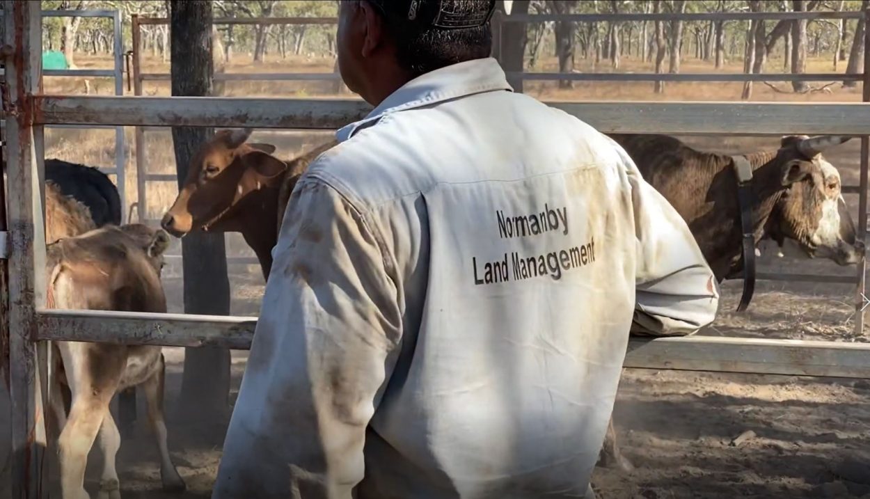
Managing herds at Normanby Station, QLD.
Project Background
- Northern Australia covers a vast and remote area of around 3 million square metres, from Karratha in WA to Rockhampton in Queensland. More than 45% of that consists of indigenous lands.
- Currently, Indigenous communities gain little benefit from the unmanaged cattle and buffalo on their lands. Feral herds damage biodiversity, cultural assets, water resources, and ground cover. They are also expensive and difficult to manage.
- The project will trial innovative satellite tracking technology to create a “road map” for the administration of unmanaged herds. It will develop technology and practises to efficiently handle unmanaged cattle and buffalo in Northern Australia to support landscape restoration and protection of cultural and environmental assets.
- This project uses new satellite tracking technology and specially developed ear tags to track animal movement and health. This is the first time this technology has been deployed
- It will see four indigenous organisations partnering with Australia’s national science agency (CSIRO), Northern Australia’s two leading universities (James Cook University and Charles Darwin University), and the global satellite company Kineis.
- Indigenous leadership is a key aspect of this project. NAILSMA is the leading Northern Australian Indigenous research organisation
- During the project 1000 buffalo and cattle will be tagged and tracked by satellite across some of Australia’s most remote locations, including Arnhem Land NT, the Upper Normanby and Archer River catchments on Cape York Peninsula QLD. A combined area of 22,314 square kilometres.
- Animal welfare is our number one priority. The project has been subject to strict ethics approvals and all of our partners are trained in humane handling using a package specially developed by NAILSMA and CSIRO
- Indigenous communities in Northern Australia will benefit from the project through the creation of online training with step by step instructions, tutorials and videos on the project’s processes and technology. Towards the end of the project regional workshops will also be held in Arnhem Land and Cape York. Reference designs and software for the animal tracking ear tags will also be available to our indigenous partners and other indigenous organisations without cost.
Partners
This project is a partnership between The North Australian Indigenous Land and Sea Management Alliance Ltd (NAILSMA), CSIRO, Aak Puul Ngantam (APN), Normanby Land Management and Mimal Land Management, James Cook University (JCU) and Kinéis (Satellite Company).
For further information on this project please contact admin@nailsma.org.au